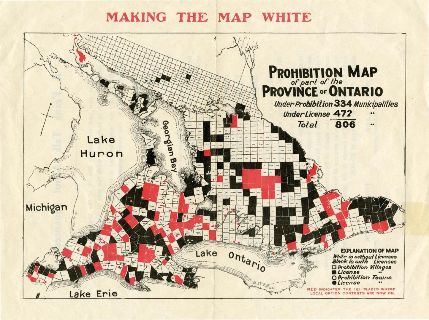

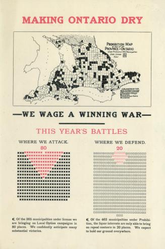
Prohibition map of part of the Province of Ontario
Date1909
Names
Dominion Alliance, Ontario Branch
(author)
Format
Subject
Medium
Dimensions23 cm x 31 cm (9 1/16 in. x 12 3/16 in.)
Language
CollectionBaldwin Collection of Canadiana
Usage Rights
Public Domain
(Learn More)
Call Number / Accession Number1909-PROHIBITION-MAP-S
Country:Canada
Province or state:Ontario
![Prohibition leaffets [sic] : prohibition in Kansas](/internal/media/filedispatcher/747118/thumbnail)
approximately 1902
1910 circa
1902 circa
1913 circa