
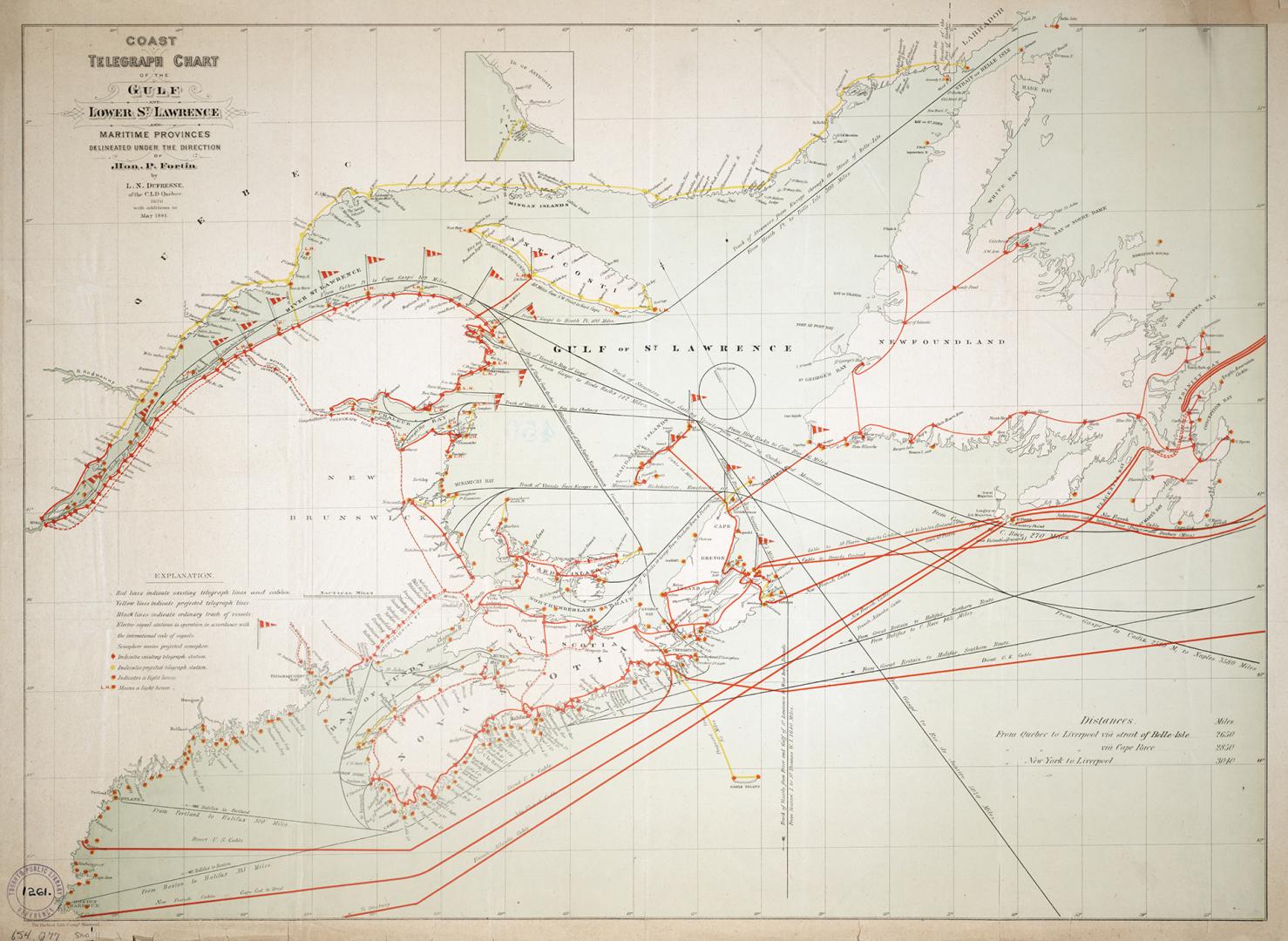

Coast telegraph chart of the Gulf and lower St. Lawrence and Maritime Provinces
Date1881
Names
Burland Lith. Company Montreal
(contributor)
Dufresne, L. N.
(contributor)
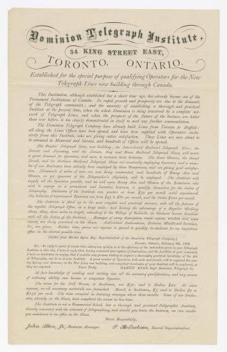
Fortin, P.
(contributor)
Montreal Board of Trade
(author)
FormatMap
Dimensions54 cm x 73 cm (21 1/4 in. x 28 3/4 in.)
Language
CollectionBaldwin Collection of Canadiana
Usage Rights
Public Domain
(Learn More)
Object Number654-Q77-MEDIUM
Dewey654 Q77 (medium)
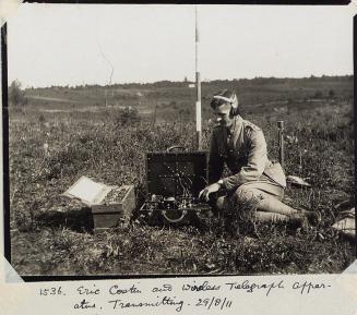
Approximately 1930
Approximately 1883
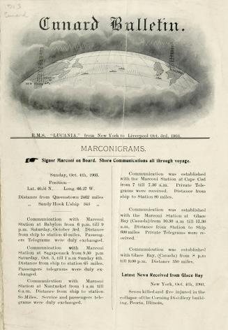
1903
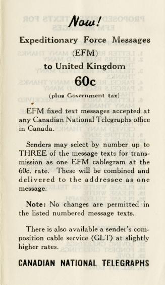
Between 1939 and 1945
[1920?]