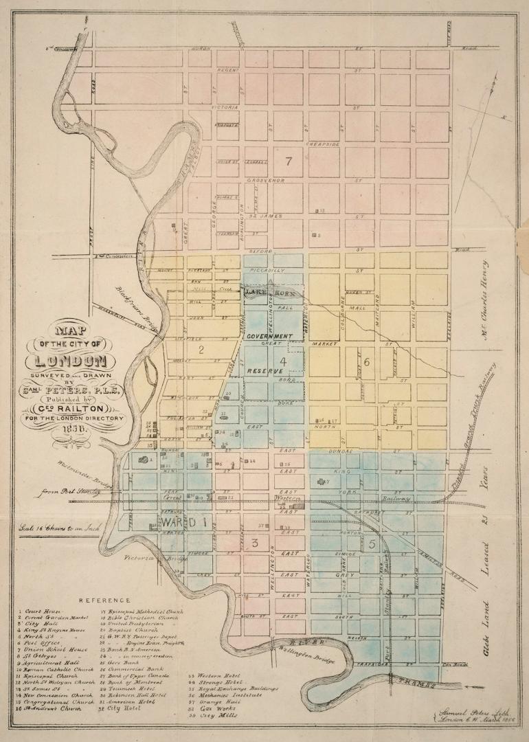

Map of the city of London surveyed and drawn by Samuel Peters, P.L.S. published by Geo Railton for the London Directory 1856
Date1856
Names
Format
Subject
Medium
Dimensions1Pages, 19 x 17 cm (7 1/2 x 6 11/16 in.)
Language
CollectionBaldwin Collection of Canadiana
Usage Rights
Public Domain
(Learn More)
Call Number / Accession Number912-71326-P26-SMALL
1595
1581
1566