

The mapp and description of New-England; together with a discourse of plantation, and colonies: also, a relation of the nature of the climate and how it agrees with our owne country England. How neere it lyes to Newfoundland, Virginia, Nova Francia, Canada, and other parts of the West-Indies
Date1630
Names
Nathaniel Butter, An. Dom. 1630
(publisher)
Format
Second issue, without original dedication and with new title page, of author's Encouragement to colonies, published London, 1624.
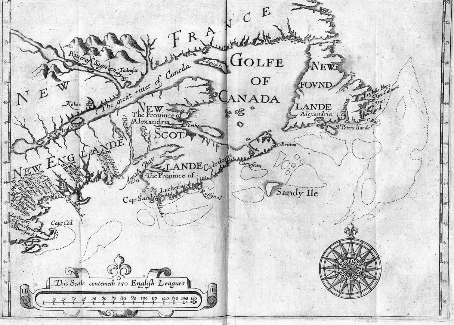
Folding map facing p. 1, one of the first of New England and the Maritimes, shows eastern coast of North America from Cape Cod to the Gulf of St. Lawrence. "The main sources appear to be Lescarbot's map of New France and John Smith's map of New England.": Kohl 167. A larger version appeared in Vol. IV of the 1625 ed. of Purchas his pilgrimes.
"This is a record of the Earl of Stirling's unsuccessful attempt to found a Scottish colony in Nova Scotia, to which he gave its name. It gives some account of the French settlement in New France.": Church 400.
"This is a record of the Earl of Stirling's unsuccessful attempt to found a Scottish colony in Nova Scotia, to which he gave its name. It gives some account of the French settlement in New France.": Church 400.
Medium
Dimensions25 x 19 cm (9 13/16 x 7 1/2 in.)
Language
CollectionBaldwin Collection of Canadiana
Usage Rights
Public Domain
(Learn More)
Call Number / Accession Number37131055489892D
Dewey Number970.01 S74 \B BR
Catalogue Record for Print Bookhttps://www.torontopubliclibrary.ca/detail.jsp?Ntt=1766173
Country:Canada
Historical location:New France
Province or state:Nova Scotia
Region or district:Maritime Provinces
1832