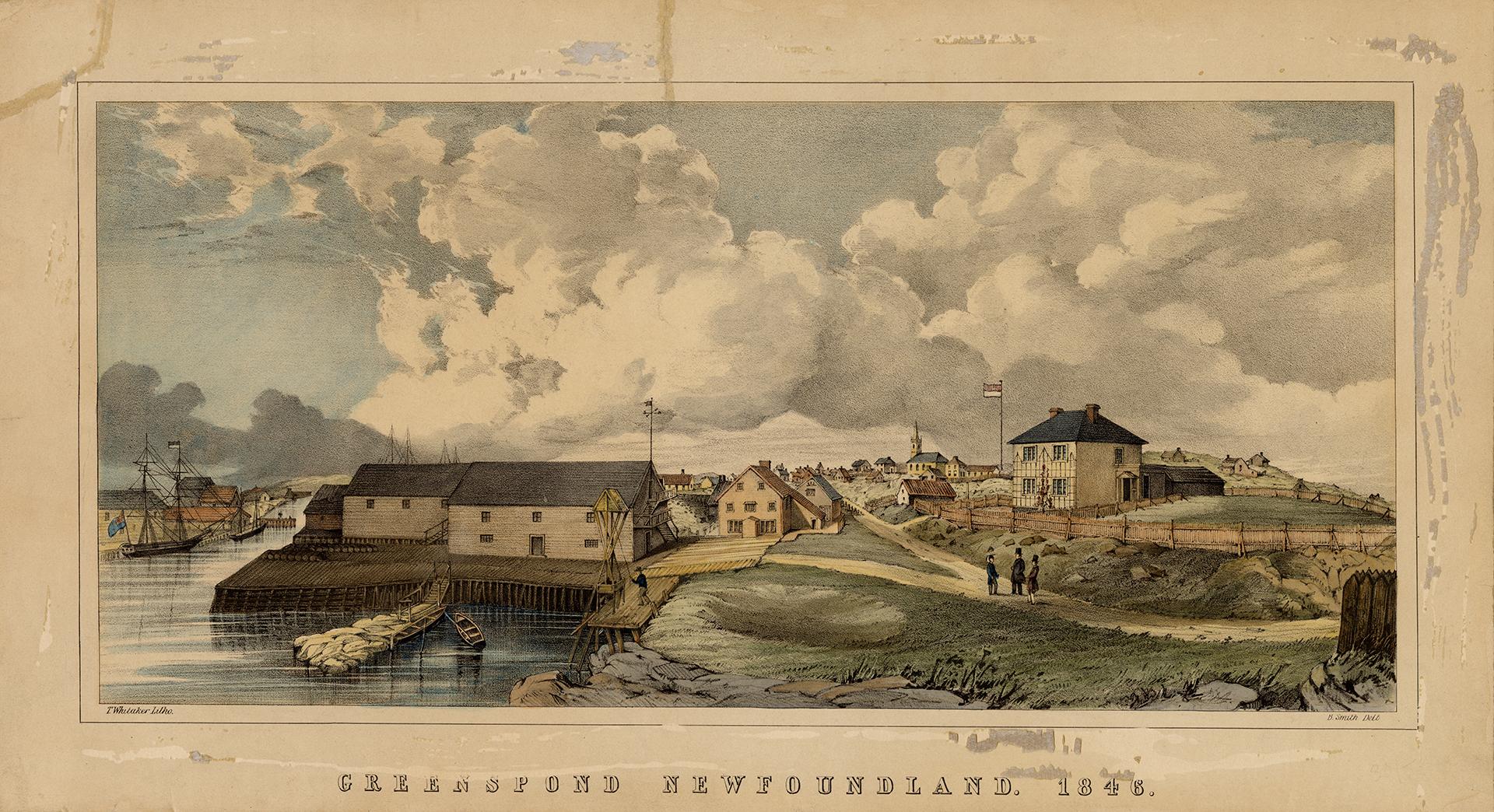


Greenspond, Newfoundland, 1846
Date1846
Names
Smith, Benjamin, active 1846-1887
(attributed name)
FormatPicture
NotesOriginal drawn by B. Smith and litoghraph illustrated by T. Whitaker of London, England.
Lithograph and watercolour on wove paper. Laid down on cardboard
"View from the south, showing the outer harbor on the left, and part of Bonavista Bay, on the north side of which Greenspond is situated. The harbor is formed by the Island of Greenspond on the one side and Newell's and Ship Island on the other. Puffin Island is at the entrance to the harbor. Although a barren island, considerable business has been done and is done at Greenspond. T. Whitaker, litho. B. Smith, delt. Lithograph in color. Size 7 x 15."-- from Landmarks of Canada (Toronto Public Library, 1967).
Image illustrated in Charles P. De Volpi, Newfoundland, a pictorial record: historical prints and illustrations of the province of Newfoundland, Canada, 1497-1887 (Don Mills, Ont.: Longman Canada, 1972), 25.
Inscribed in the print, l.l.: T. Whitaker Litho,; i.r.: B. Smith Delt; b.: GREENSPOND NEWFOUNDLAND. 1846. Inscribed in pencil, l.r.: 30/- Key (190-?), in pen and ink on bottom of former mat (now separate), identifies figures in right foreground as (l. to r.?) Dr. Winter (with silk hat) / Rev Mr Morton, Anglican Clergyman and Mr. Wells, agent for Brooking & Co. Reps 2957; deVolpi 25.
Subject
Dimensions184 x 380; 204 x 380 (with text and border); 234 x 425 mm
Language
CollectionBaldwin Collection of Canadiana
Usage Rights
Public Domain
(Learn
More)
Copyright HolderUnknown
Object NumberJRR 2259 Cab II