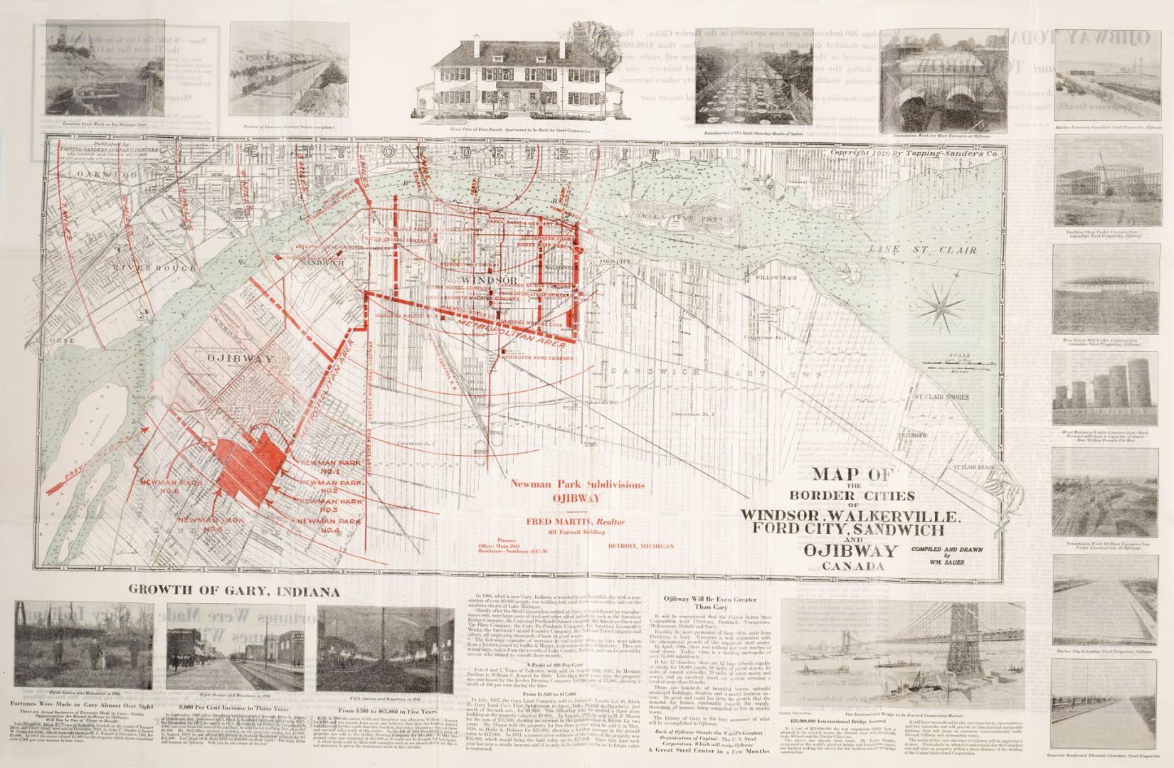

Map of the Border Cities of Windsor, Walkerville, Ford City, Sandwich and Ojibway Canada
Date1920
Names
Sauer, William C.
(cartographer)
Topping-Sanders Company
(publisher)
Format
On verso, planning map of Ojibway, with houses, house numbers, with planning and real estate information. Also includes an article on the growth and development of Gary Indiana, and a promise that Ojibway will be even greater than Gary. Fred Martin, Realtor, Newman Park Subdivisions, Ojibway.
Dimensions55.5 cm x 86 cm (21 7/8 in. x 33 7/8 in.)
Language
CollectionBaldwin Collection of Canadiana
Usage Rights
Public Domain
(Learn More)
Call Number / Accession Number912-7133-S134
Dewey Number912.7133 S134
Country:United States
City, town or township:Walkerville (Windsor, Ont.)
Geograhical feature:St. Clair, Lake (Ont.)
Historical location:Sandwich Settlement (Ont.)
Province or state:Ontario