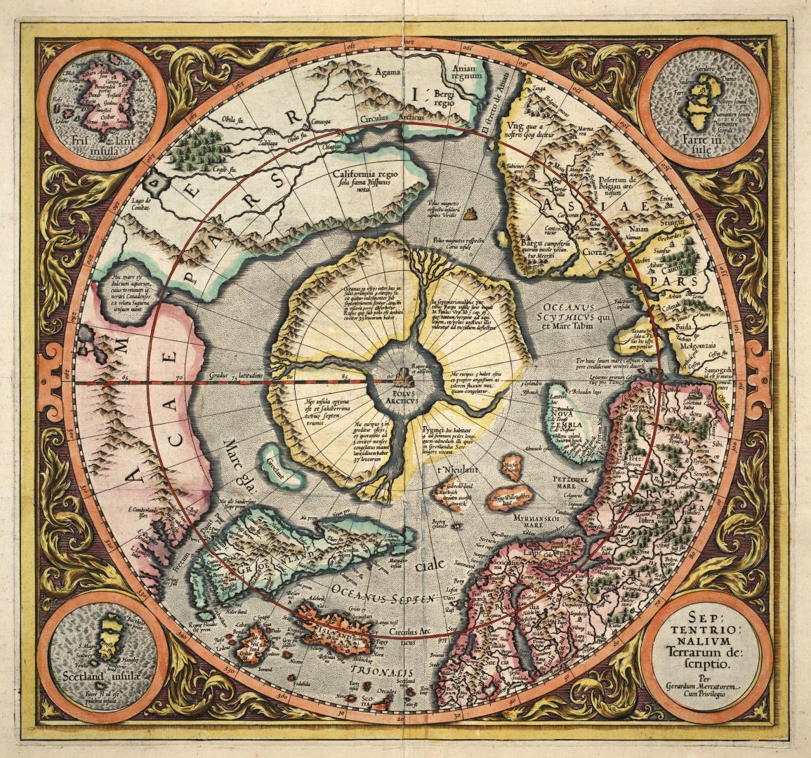

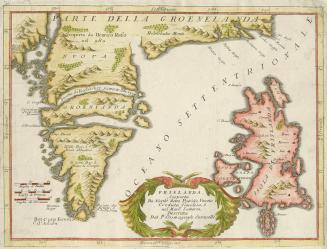
Septentrionalium terrarum descriptio
Date1613
Names
Mercator, Gerhard, 1512-1594
(cartographer)
Hondius, Jodocus, 1563-1612
(cartographer)
Hondius, Jodocus, 1563-1612
(engraver)
Format
First printed map of the North Pole, originally published in 1595. Depicts the mythical island of Frisland.
Subject
Medium
Dimensions41 cm x 44 cm (16 1/8 in. x 17 5/16 in.)
Language
ProvenanceFrom the George Weston Limited donation of printed maps and illustrations 2002
CollectionBaldwin Collection of Canadiana
Usage Rights
Public Domain
(Learn More)
Call Number / Accession Number912-19632-M26-WESTON-4
Dewey Number912.19632 M26 (Weston donation maps drawer, map #4)
Geograhical feature:North Pole
Region or district:Europe

Approximately 1925
Approximately 1920
Approximately 1905