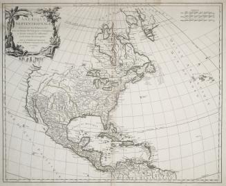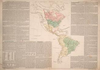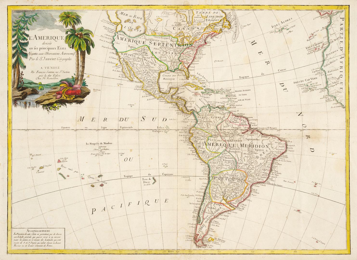

L'Amerique divisée en ses principaux etats assujettie aux observations astronomiqes...
Date1780
Names
Santini, Paolo, 1729?-1793
(engraver)
Janvier, Jean Denis fl. 1746-1779
(cartographer)
Remondini (Firm)
(publisher)
Lattre, Jean, fl. 1743-1793
(engraver)
Format
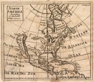
This map features the mythical "Sea of the West" which appeared on many European maps of North America in the eighteenth century. The sea is depicted as a large, western inland body of water, hundreds of miles in diameter, with a small inlet to the Pacific Ocean and even some interior islands with the entries thereto discovered by Juan De Fuca in 1591 and by Martin D'Aguilar in 1603. This map is a reissue of map by Jean Janvier and Jean Lattré (first issued in ca.1760). Jean Denis Janvier fl. 1746-1779 was a French cartographer was also known as "Sieur Jean Janvier" and "Robert Janvier"
Subject
Medium
Language
CollectionBaldwin Collection of Canadiana
Usage Rights
Public Domain
(Learn More)
Call Number / Accession Number912-7-S12-1-SMALL
Dewey Number912.7 S12.1 SMALL
Country:United States
Region or district:South America