
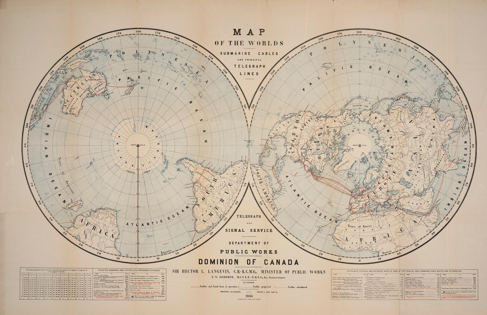

Map of the World's submarine cables and principal telegraph lines
Date1883
Names
Canada. Department of Public Works
(author)
Langevin, Hector, Sir, 1826-1906
(contributor)
G.E. Desbarats
(publisher)
Gisborne, F.N. (Frederick Newton), 1824-1892
(contributor)
FormatMap
NotesPrepared by the telegraph and signal service Department of Public Works, Dominion of Canada. Sir Hector L. Langevin, Minister, F.N. Gisborne, superintendent
Dimensions65 cm x 102 cm (25 9/16 in. x 40 3/16 in.)
Language
CollectionBaldwin Collection of Canadiana
Usage Rights
Public Domain
(Learn
More)
Object Number384-10223-C12
Dewey384.10223 C12

Approximately 1930
Approximately 1883

14 September 1927
1903