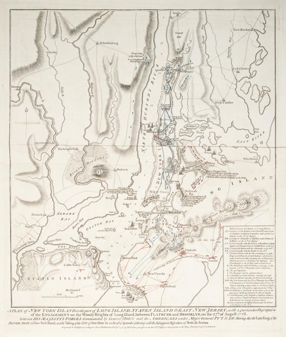

A plan of New York Island, with part of Long Island, Staten Island & East New Jersey, with a particular description of the Engagement on the Woody Hei(...)
Date1776
Names
Faden William, 1749-1836
(author)
Wm. Faden
(publisher)
FormatMap
NotesA plan of New York Island, with part of Long Island, Staten Island & East New Jersey, with a particular description of the Engagement on the Woody Heights of Long Island, between Flatbush and Brooklyn, on the 27th of August 1776. Between his majesty's forces commanded by General Howe and the Americans under Major General Putnam shewing also the Landing of the British Army on New-York Island, and the taking of the City of New-York & on the 15th of September following, with the Subsequent Disposition of Both the Armies
Medium
Dimensions1"=1.3 miles : 47.5 x 42.5 cm on sheet 60 x 49.5 cm
Language
ProvenanceGift of James Bain family, 2008
CollectionBaldwin Collection of Canadiana
Usage Rights
Public Domain
(Learn More)
Object Number912.7471F11
Dewey912.7471 F11
Approximately 1910