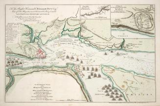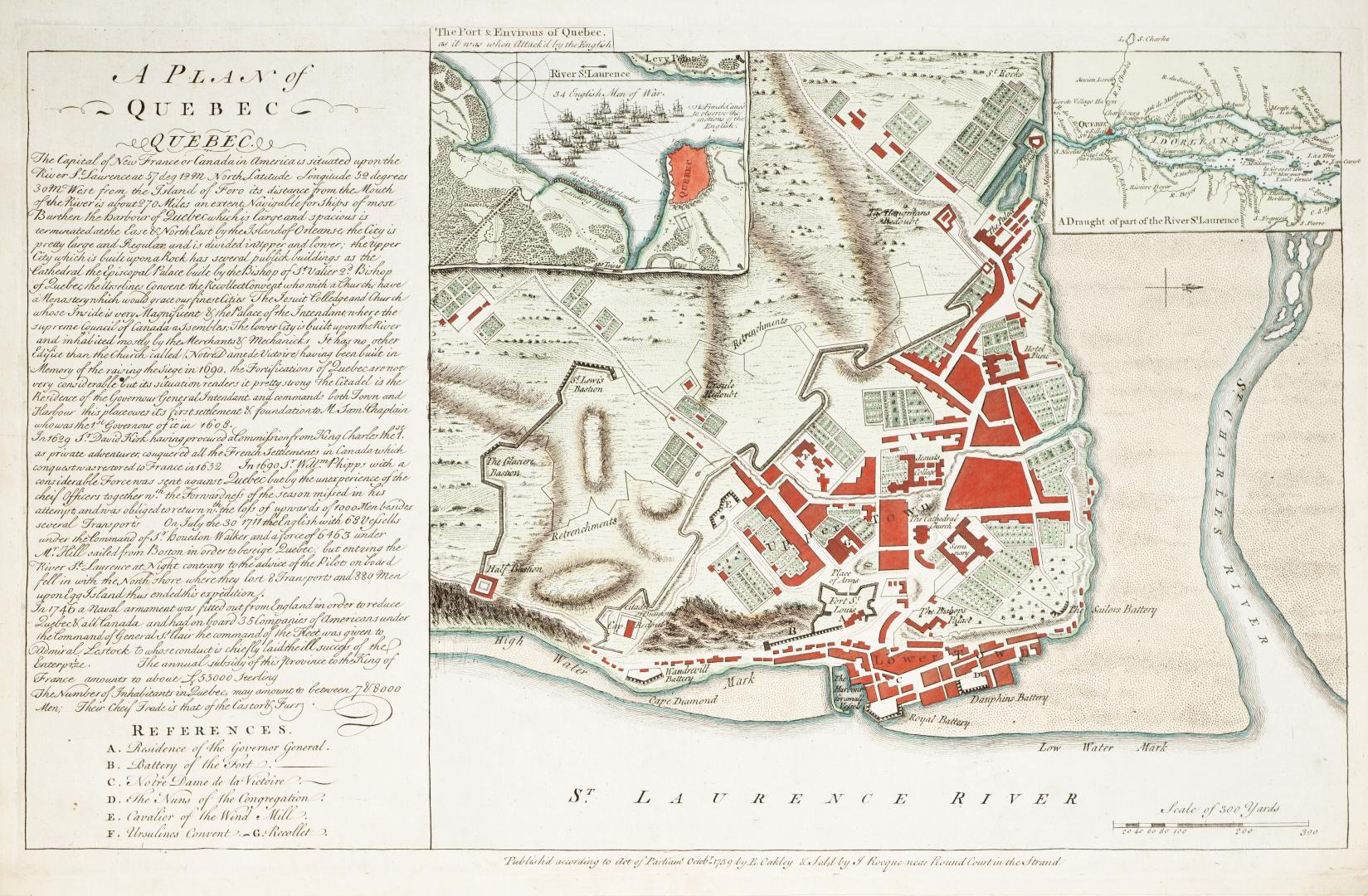

A plan of Quebec
Date1759
Names
Oakley, E.
(publisher)
Rocque, J., 1709-1762
(contributor)
FormatMap
NotesPlate from ''Atlas des Colonies Angloises en Ameriques'', includes two inset maps ''The Port & Environs of Quebec as it was when attack'd by the English'' and ''A Draught of part of the River St. Laurence''.
Subject
Dimensions39.5 cm x 54 cm (15 9/16 in. x 21 1/4 in.)
Language
ProvenanceGift of James Bain family, Toronto, 2008
CollectionBaldwin Collection of Canadiana
Usage Rights
Public Domain
(Learn More)
Object Number912-71447-O12
Dewey912.71447 O12