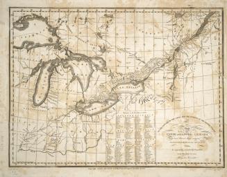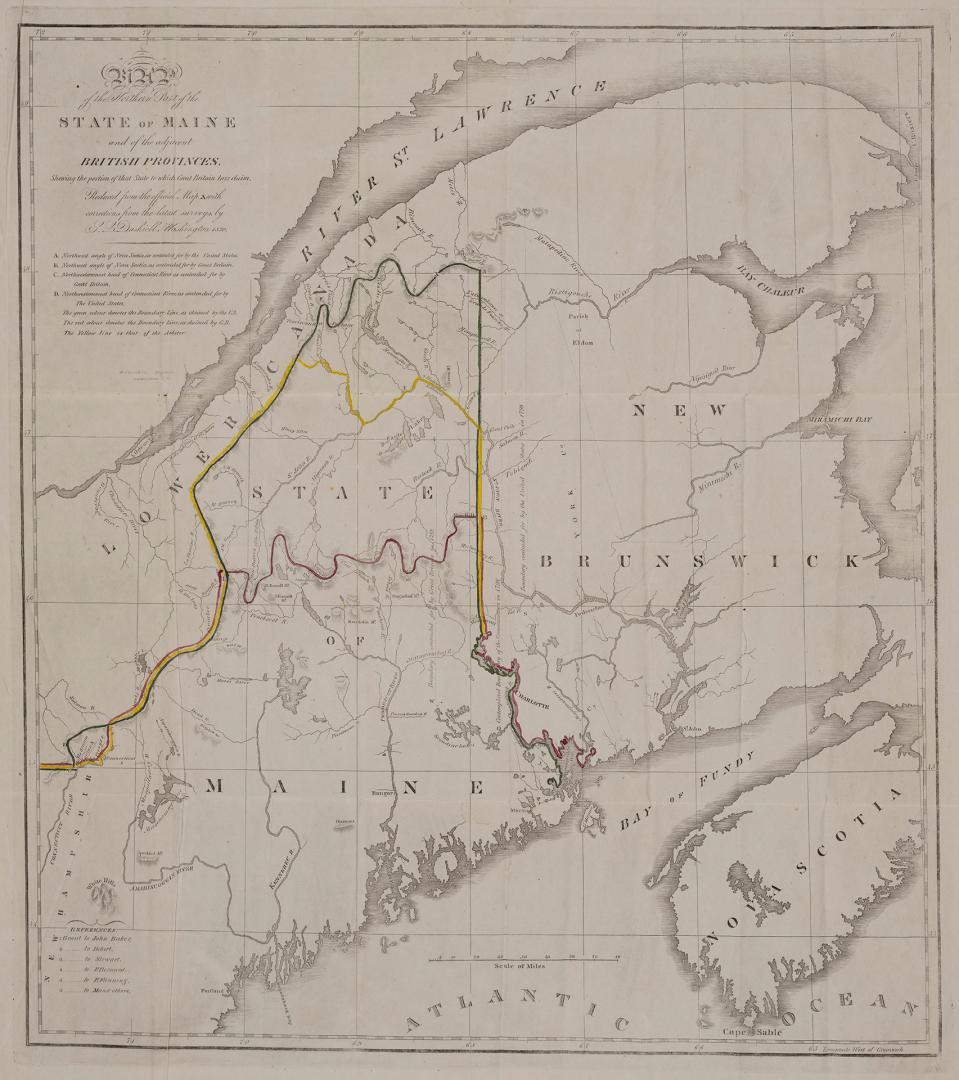

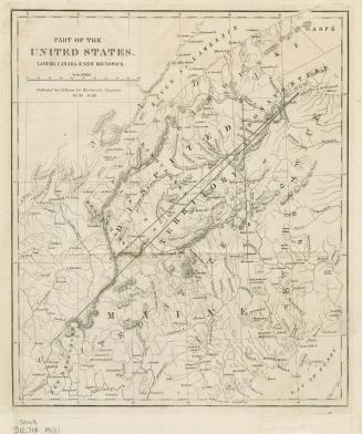
Map of the northern part of the state of Maine and of the adjacent British provinces : shewing the portion of that state to which Great Britain lays claim
Date1830
Names
Dashiell, S. L.
(author)
Stone, William James 1798-1865
(contributor)
FormatMap
Notes| This map focuses on the Maine boundary dispute between the United States and Great Britain. The dispute was settled during the Aroostook War, a nonviolent confrontation that ended in 1842 with the Webster-Ashburton Treaty of Washington. |
Medium
Dimensions53 cm x 43 cm (20 7/8 in. x 16 15/16 in.)
ScaleBar scale (miles)
ScaleApproximately 1:1,600,000
Language
CollectionBaldwin Collection of Canadiana
Usage Rights
Public Domain
(Learn More)
Object Number912-714-D13-SMALL
Dewey912.714 D13 SMALL
Approximately 1840