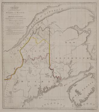

Part of the United States, Lower Canada & New Brunswick
DateApproximately 1840
Names
Mason, J.M. (Jemima M.)
(publisher)
Blackwood's Edinburgh magazine
(publisher)
Format
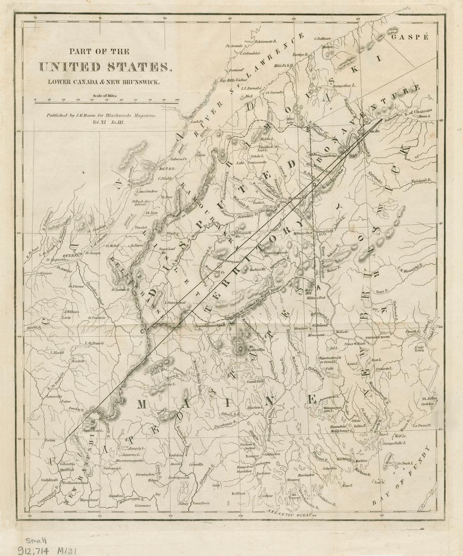
| This map focuses on the Maine boundary dispute between the United States and Great Britain. The dispute was settled during the Aroostook War, a nonviolent confrontation that ended in 1842 with the Webster-Ashburton Treaty of Washington. Adapted from an 1832 map by the Society for the Diffusion of Useful Knowledge, North America Sheet II Lower Canada and New Brunswick with Part of New York, Vermont and Maine. Published by J.M. Mason, for Blackwoods Magazine/Vol. XI No. III. |
Medium
Dimensions35.5 cm x 28 cm (14 in. x 11 in.)
ScaleBar scale (miles)
Language
CollectionBaldwin Collection of Canadiana
Usage Rights
Public Domain
(Learn More)
Call Number / Accession Number912-714-M131-SMALL
Dewey Number912.714 M131 SMALL
Country:Canada
Province or state:Maine
Region or district:North America