
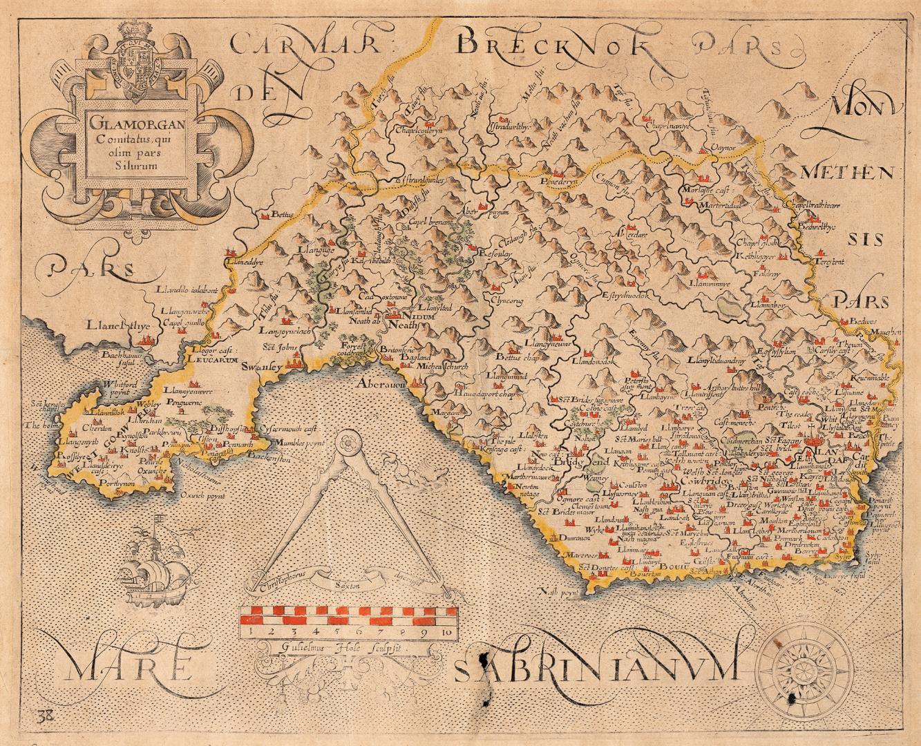

Glamorgan comitatus qui olim pars silurum
DateApproximately 1637
Names
Saxton, Christopher, 1542?-
(cartographer)
Saxton, Christopher, 1542?-
(draftsman)
Format
An early map of Wales by English cartographer Christopher Saxton. Saxton produced the first printed map of England and his maps are highly prized for their accuracy and high quality. His maps "are excellent in every way.....and set a standard and remained the base for succeeding county maps for over a hundred years" (Tooley-"Maps and Map Makers").
Subject
Medium
Dimensions29 cm x 35 cm (11 7/16 in. x 13 3/4 in.)
ScaleBar scale
Language
CollectionBaldwin Collection of Canadiana
Usage Rights
Public Domain
(Learn More)
Call Number / Accession Number912-42989-S138
Dewey Number912.42989 S138 (Europe maps drawer)
Country:Wales

Approximately 1870
Approximately 1870