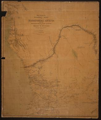
Map showing the Eastern half of equatorial Africa and the explorations by land and water of Henry M. Stanley in the years 1874-77
DateApproximately 1880
Names
Weller, Edward, 1819-1884
(engraver)
James Campbell & Son
(publisher)
FormatMap
NotesShow's Stanley's route from the Congo River east to Lakes Tanganyika & Victoria and to coast at Zanzibar. Companion map shows west part of map.
Subject
Dimensions80 cm x 65 cm (31 1/2 in. x 25 9/16 in.)
Language
CollectionBaldwin Collection of Canadiana
Usage Rights
Public Domain
(Learn
More)
Object Number912-67-W25
Dewey912.67 W25 (Asia/Africa/Australia map drawer)