
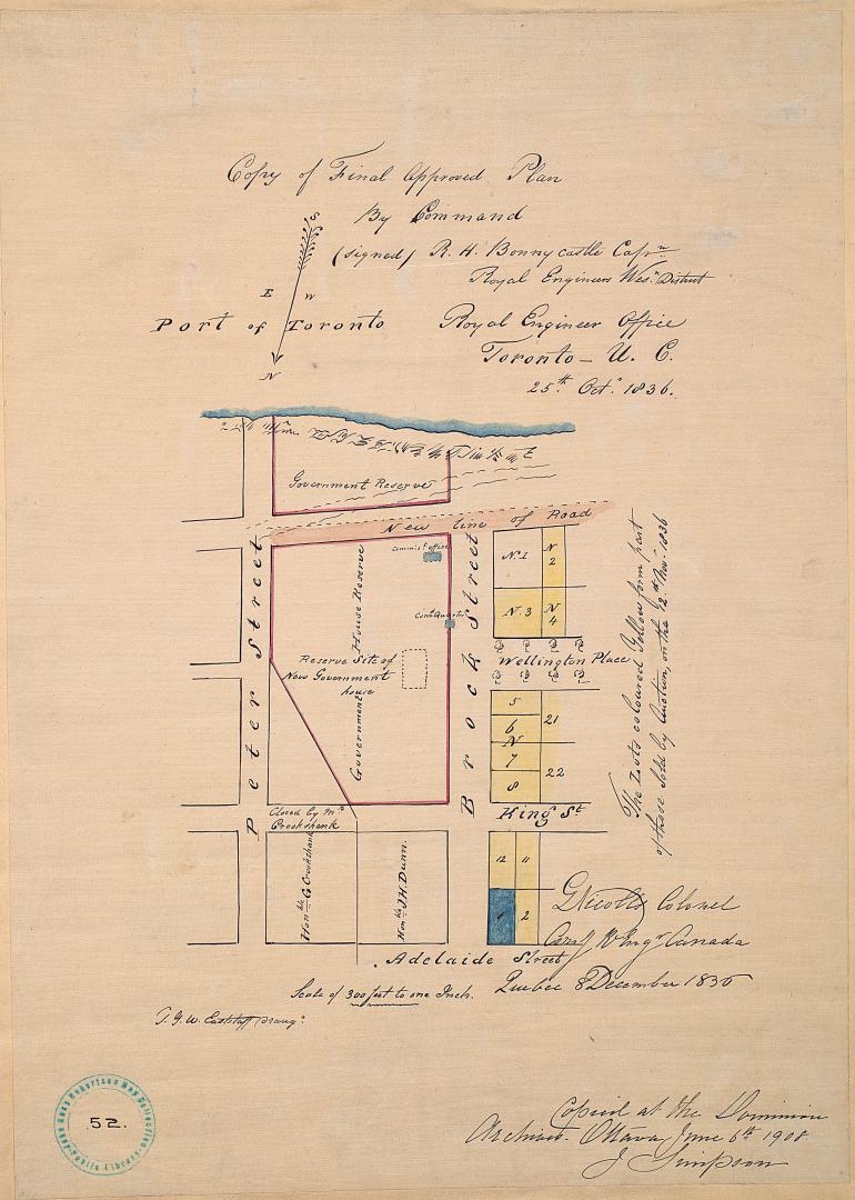

(1836) Copy of final approved plan, by Command
Date1908
Names
Bonnycastle, R.H.
(cartographer)
J. Simpson
(contributor)
Nicolls, G. Colonel
(contributor)
Royal Engineer Office (Toronto, Ont.)
(publisher)
Robertson, J. Ross (John Ross), 1841-1918
(contributor)
FormatMap
NotesJune 6th, 1908 reproduction by J. Simpson, of original 1836 map from the Archives Department, Ottawa (current day Library and Archives Canada).
Dimensions46 x 36 cm
Scale1 inch = 300 feet
Language
ProvenanceGift of John Ross Robertson (JRR collection #52)
CollectionBaldwin Collection of Canadiana
Usage Rights
Public Domain
(Learn More)
Object NumberT-1836-SMALL
There are no works to discover for this record.