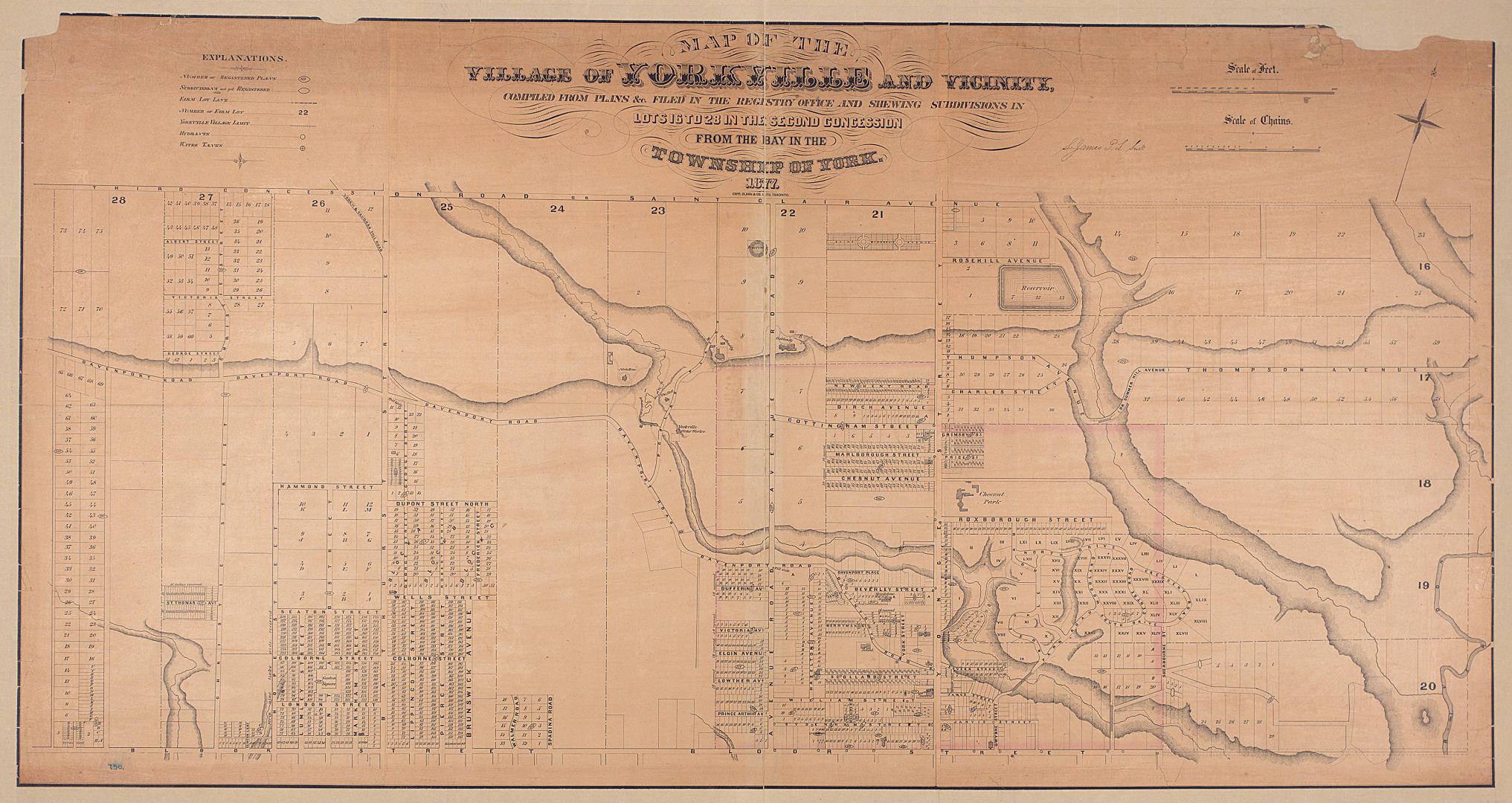

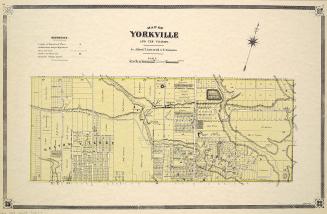
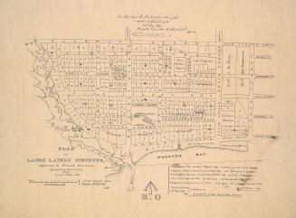
Map of the village of Yorkville and vicinity, compiled from plans & filed in the Registry Office
Date1877
Names
Copp Clark Company
(publisher)
James, Silias, 1834-1915
(cartographer)
Copp Clark Company
(lithographer)
Format
Shows number of registered plans, unregistered subdivisions, farm lot lines, farm lot numbers, Yorkville village limit, hydrants and water tanks.
Dimensions80 cm x 130 cm (31 1/2 in. x 51 3/16 in.)
Scale1 inch = 300 feet
Language
CollectionBaldwin Collection of Canadiana
Usage Rights
Public Domain
(Learn More)
Call Number / Accession NumberT-1877-LARGE
Country:Canada
City, town or township:Toronto
East-west street:St. Clair Avenue West
Neighbourhood:Seaton Village
North-south streeet:Bathurst Street
Province or state:Ontario
Approximately 1908