
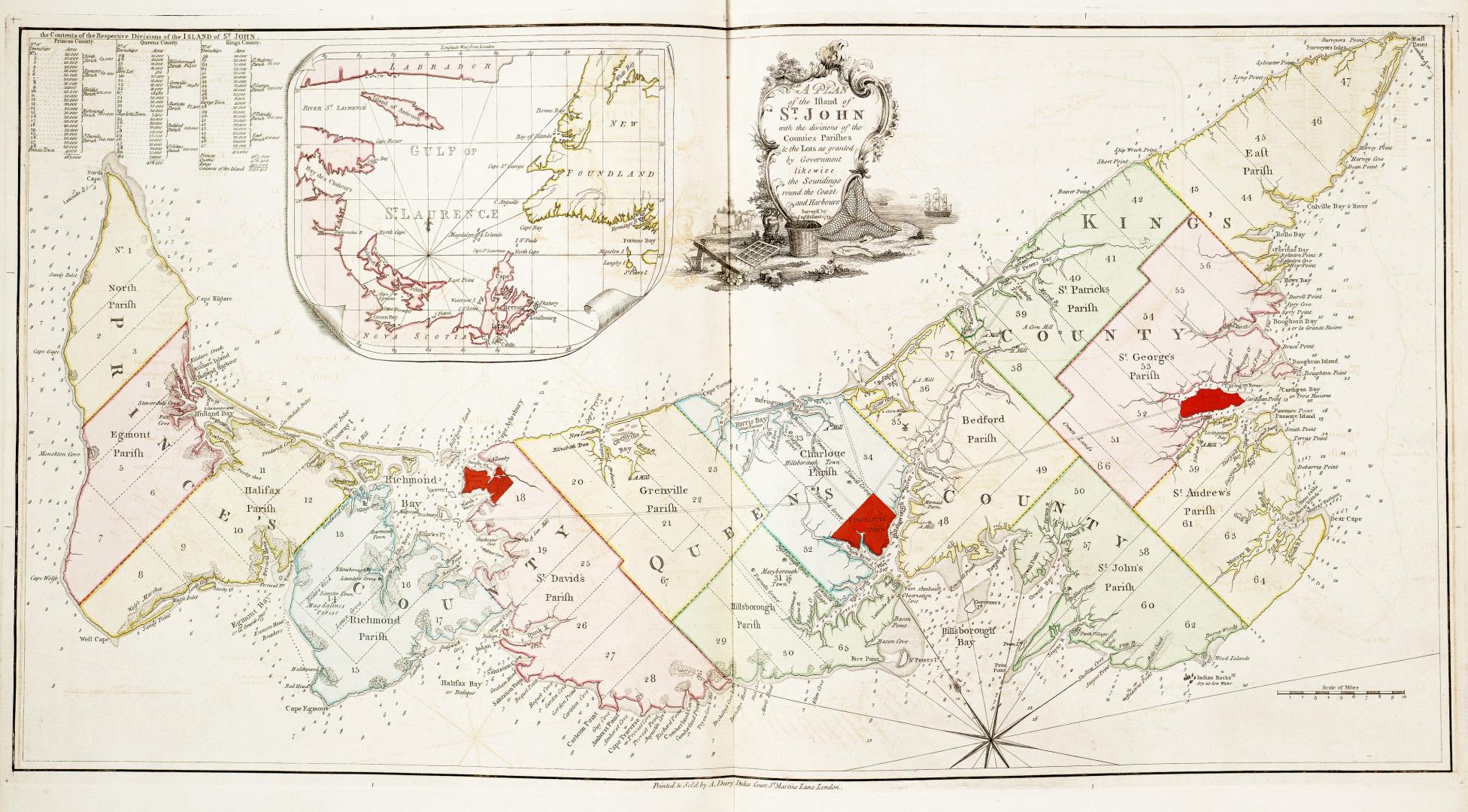

A plan of the Island of St. John with the divisions of the counties, parishes & the lots as granted by Government likewise the soundings round the coast and harbours, surveyed by Capt. Holland
Date1775
Names
FormatMap
Medium
Dimensionsca 1"=4 miles : 36.5 x 70.5 cm on sheet 54 x 73 cm
Language
ProvenanceGift of James Bain family, 2008
CollectionBaldwin Collection of Canadiana
Usage Rights
Public Domain
(Learn More)
Object Number912-717H58
Dewey912.717 H58

Approximately 1760