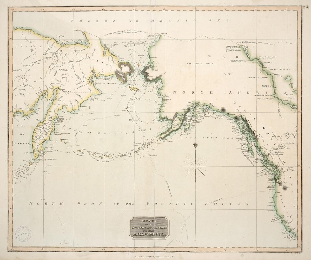

Chart of the northern passage between Asia & America
Date1816
Names
J. Thomson
(publisher)
Neele, Samuel John, 1758-1824
(engraver)
Neele, Samuel John, 1758-1824
(cartographer)
FormatMap
NotesDrawn & engraved for Thomsons New General Atlas, 1816; shows routes of exploration, including Cook's voyage along the coast
Subject
Dimensions54 cm x 74 cm (21 1/4 in. x 29 1/8 in.)
Scale1:15 000 000
Language
CollectionBaldwin Collection of Canadiana
Usage Rights
Public Domain
(Learn More)
Object Number912-7-T35-1-MEDIUM
Dewey912.7 T35.1 (medium)