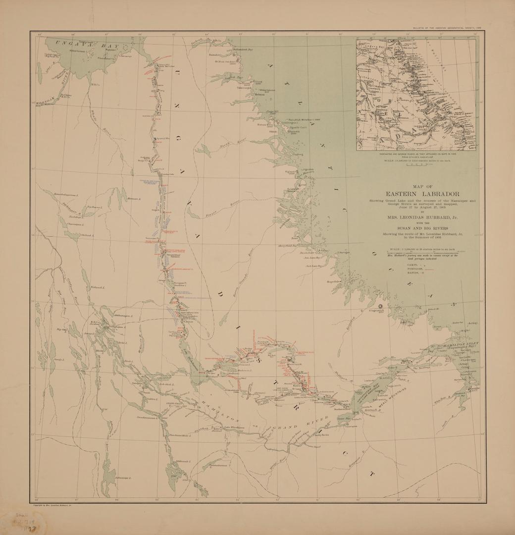

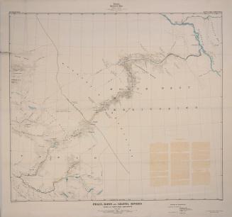
Map of Eastern Labrador showing Grand Lake and the courses of the Nascaupee and George Rivers as surveyed and mapped June 27 to August 27, 1905 by Mrs. Leonidas Hubbard, Jr. with the Susan and Big Rivers showing the route Mr. Leonidas Hubbard, Jr. in the summer of 1903
Date1903
Names
FormatMap
Subject
Dimensions62 cm x 56 cm (24 7/16 in. x 22 1/16 in.)
Scale25 statue miles to 1 inch
Scale1: 1,584,000
Language
CollectionBaldwin Collection of Canadiana
Usage Rights
Public Domain
(Learn More)
Object Number912-719-H77-SMALL
Dewey912.719 H77 (medium)
![[Plate 27] Atlas of the city of Toronto and vicinity from special survey founded on registered plans and showing all building and lot numbers.](/internal/media/dispatcher/1959664/thumbnail)
![[Plate 27] Atlas of the city of Toronto and vicinity from special survey founded on registered plans and showing all building and lot numbers.](/internal/media/dispatcher/2031202/thumbnail)
![[Plate 27] Atlas of the city of Toronto and vicinity from special survey founded on registered plans and showing all building and lot numbers.](/internal/media/dispatcher/2065980/thumbnail)