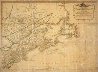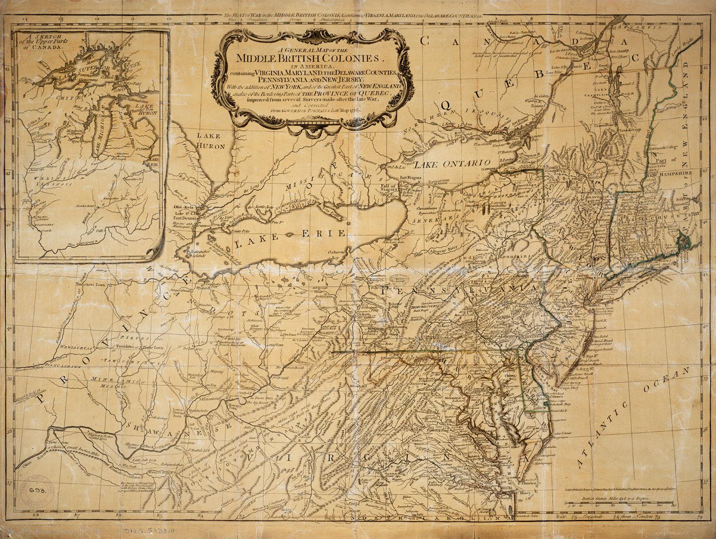

A general map of the middle British colonies, in America
Date1776
Names
Bennett, John
(contributor)
Pownall, Thomas, 1722-1805
(contributor)
Robert Sayer and John Bennett (Firm)
(publisher)
Sayer, Robert, 1725-1794
(author)
FormatMap
NotesA general map of the middle British colonies, in America. Containing Virginia, Maryland, the Delaware counties, Pennsylvania and New Jersey. With the addition of New York, and the greatest part of New England, as also of the bordering parts of the province of Quebec, improved from several surveys made after the late war, and corrected from Governor Pownall's late map 1776.
Medium
Dimensions52 x 67.5 cm Scale ca. 1:2,300,000
Language
CollectionBaldwin Collection of Canadiana
Usage Rights
Public Domain
(Learn More)
Object Number912-7-S138-11-SMALL
Dewey917.7 S138.11 SMALL