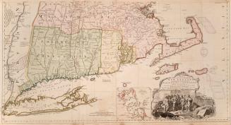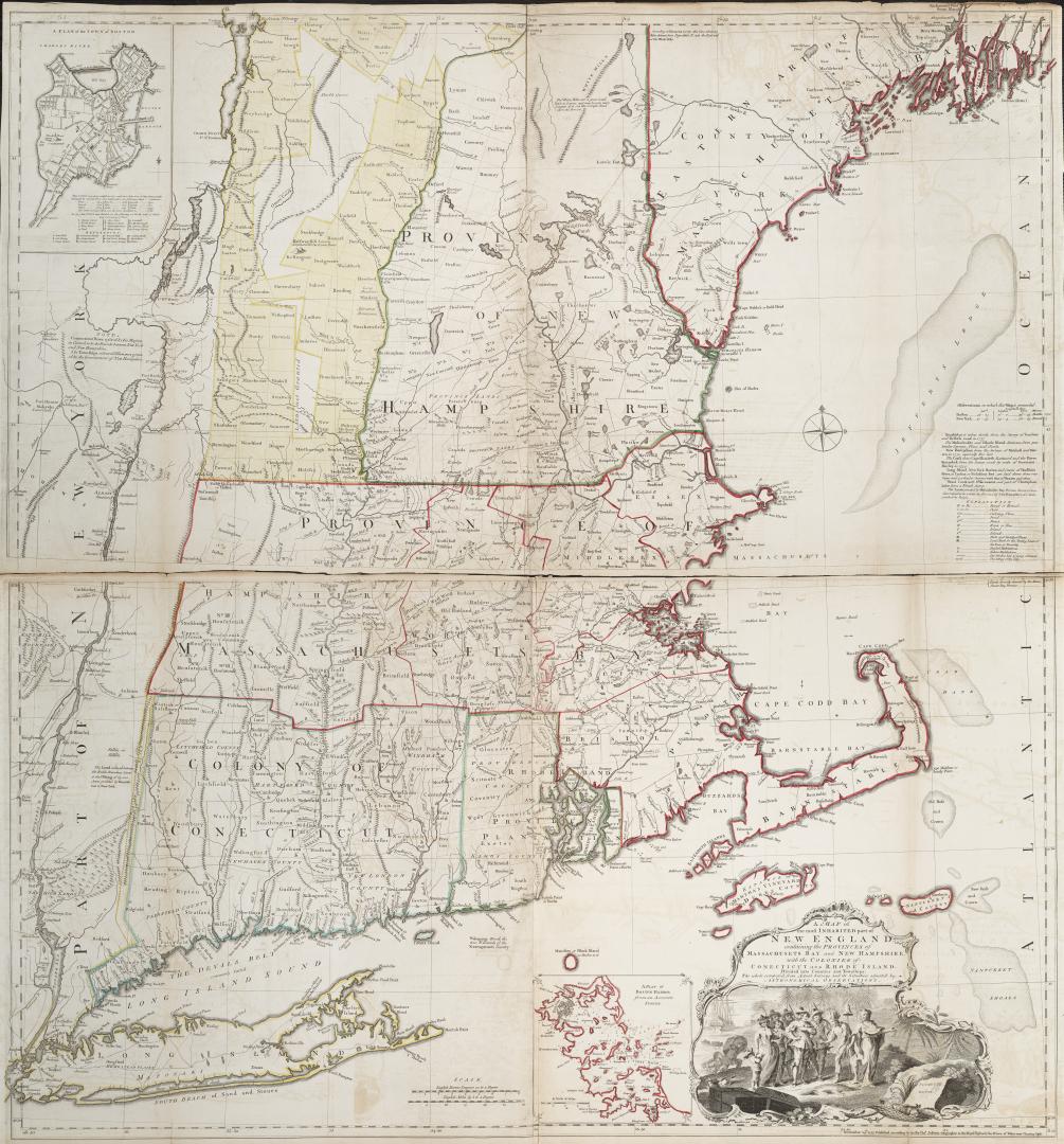

A map of the most inhabited part of New England containing the provinces of Massachusets Bay and New Hampshire, with the colonies of Connecticut and Rhode Island, Divided into Counties and Townships: The Whole composed from Actual Surveys and its situation adjusted by Astronomical Observations
Date1755
Names
FormatMap
NotesIncludes insets: A Plan of Boston Harbor from an Accurate Survey; A Plan of the Town of Boston
Subject
Dimensions53.5 cm x 103 cm (21 1/16 in. x 40 9/16 in.)
Scale7 miles to 1 inch
Language
ProvenanceGift of James Bain family, 2008
CollectionBaldwin Collection of Canadiana
Usage Rights
Public Domain
(Learn More)
Object Number912-74-J24-BAIN
Dewey912.74 J24 (Bain map drawer)