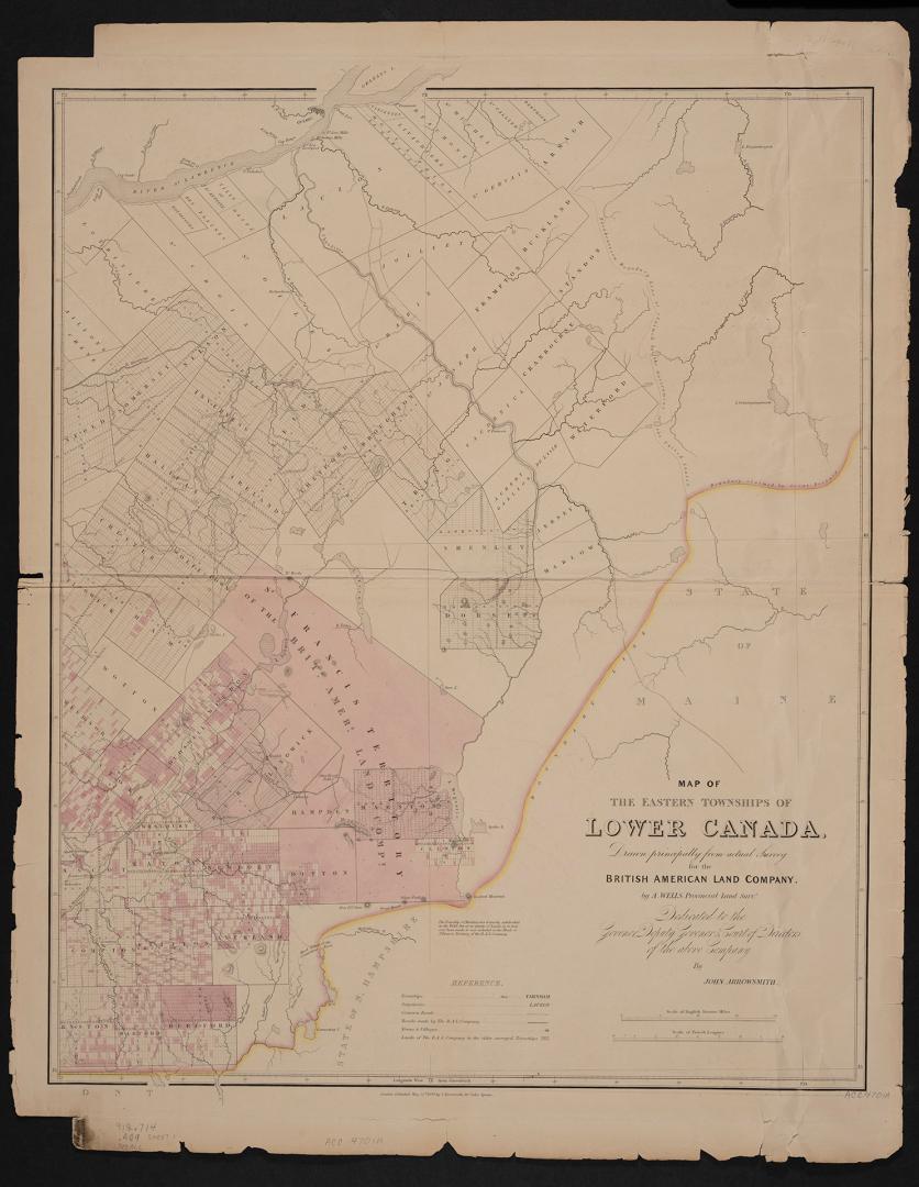

Map of the Eastern Townships of Lower Canada, drawn principally from actual survey for the British American Land Company
Date22 May 1839
Names
Arrowsmith, John, 1790-1873
(cartographer)
Arrowsmith, John, 1790-1873
(publisher)
Wells, A.
(contributor)
British American Land Company
(contributor)
FormatMap
Notes| Drawn by A. Wells provincial land surveyor for the British American Land Company. Dedicated to the Governor, Deputy Governor & Court of Directors of the British American Land Company. Includes inset of plan of Québec City. Includes table of distances to Eastern Townships. |
Subject
Dimensions69 cm x 107 cm (27 3/16 in. x 42 1/8 in.)
ScaleBar scales (English statute miles, French leagues)
Language
CollectionBaldwin Collection of Canadiana
Usage Rights
Public Domain
(Learn More)
Object Number912-714-A69-MEDIUM
Dewey912.714 A69 (medium)