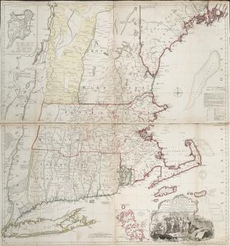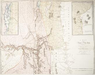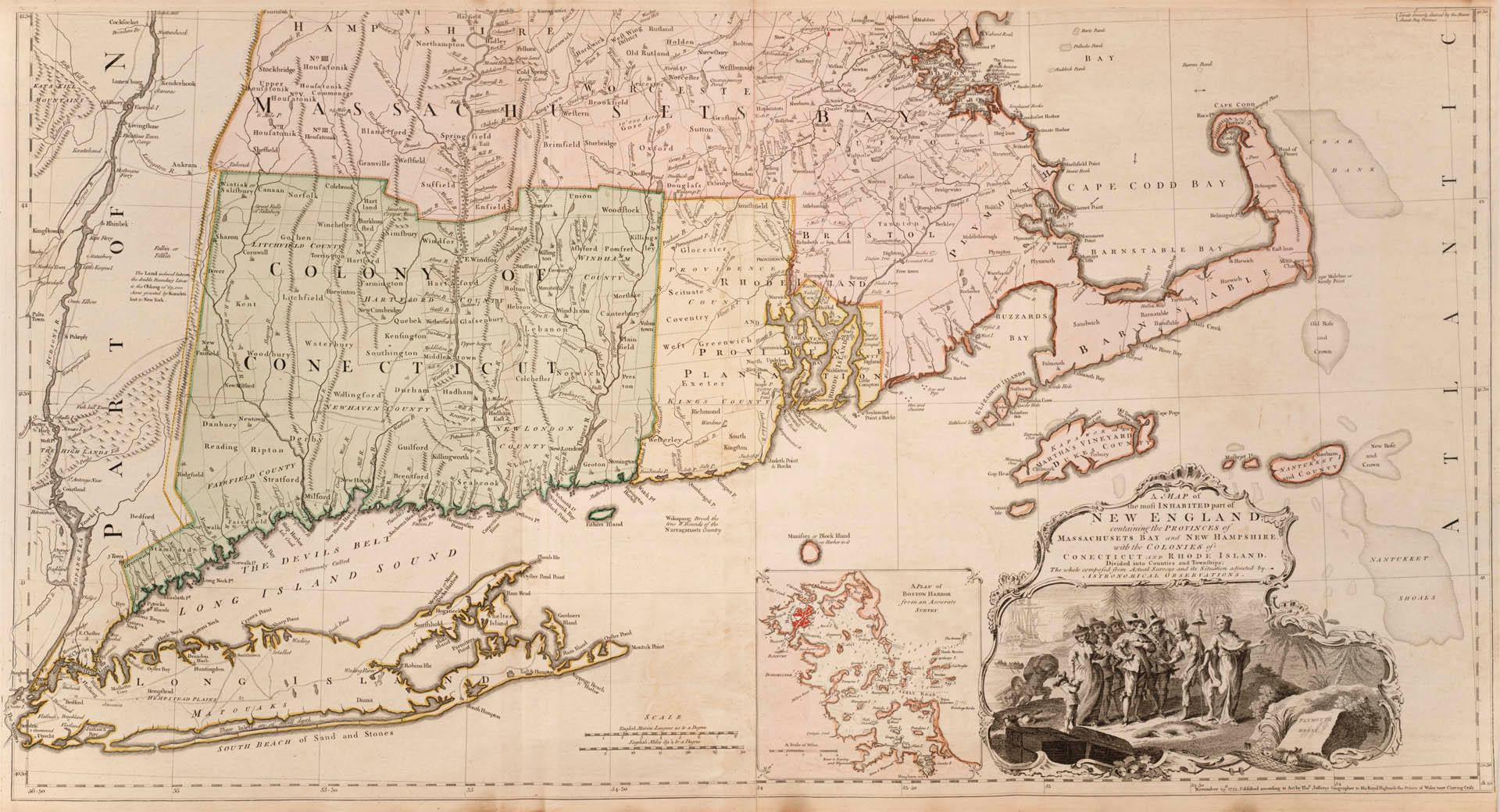

A map of the most inhabited part of New England containing the provinces of Massachusets Bay and New Hampshire, with the colonies of Connecticut and Rhode Island, Divided into Counties and Townships: The Whole composed from Actual Surveys and its Situation adjusted by Astronomical Observations
Date1774
Names
Format
South portion of map, north part digitized separately on digital archive. Includes insets: A Plan of Boston Harbor from an Accurate Survey; A Plan of the Town of Boston; First published in 1755, the 1774 edition became known as ''The Jefferys Map''
Subject
Dimensions54 cm x 101.5 cm (21 1/4 in. x 39 15/16 in.)
Scale7 miles to 1 inch
Language
ProvenanceGift of James Bain family, 2008
CollectionBaldwin Collection of Canadiana
Usage Rights
Public Domain
(Learn More)
Call Number / Accession Number912-74-J24-2-BAIN
Dewey Number912.74 J24 1774
Country:United States
Province or state:Connecticut||Massachusetts||New Hampshire||Rhode Island
Region or district:New England