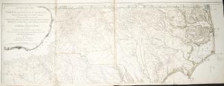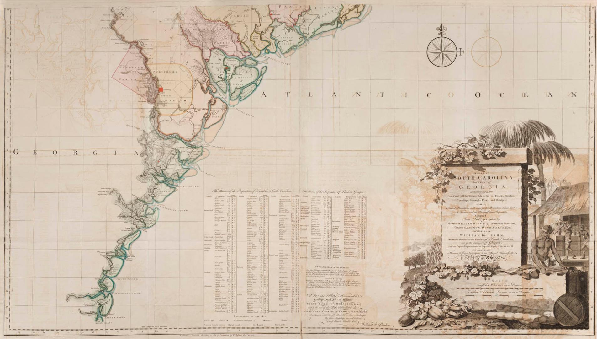

A map of South Carolina and a part of Georgia containing the whole sea coast, all the Islands, Inlets, Rivers, Creeks, Parishes, Townships, Boroughs, (...)
Date1757
Names
De Braham, William Gerard, 1717-1799
(author)
Jefferys, Thomas, -1771
(contributor)
Thomas Jefferys
(publisher)
Alternate Title
A map of South Carolina and a part of Georgia containing the whole sea coast
Format
A map of South Carolina and a part of Georgia containing the whole sea coast, all the Islands, Inlets, Rivers, Creeks, Parishes, Townships, Boroughs, Roads and Bridges as also Several Plantations with their proper boundary lines, their Names, and the Names of their Proprieters Composed of Surveys taken by The Hon. William Bull Esq. Lieutenant Governor, Captain Gascoign, Hugh Bryan, Esq; and the Author William De Brahm, Surveyor General to the Province of South Carolina, one of the Surveyors of Georgia and late Captain Engineer under his Imperial Majesty Charles VII
Medium
Dimensions1" = 5 miles : 72.5 x 124 cm and 62 x 122 cm
Language
ProvenanceGift of James Bain family, 2008
CollectionBaldwin Collection of Canadiana
Usage Rights
Public Domain
(Learn More)
Call Number / Accession Number912-757D24
Dewey Number912.757 D24
Country:United States
Province or state:South Carolina||Georgia