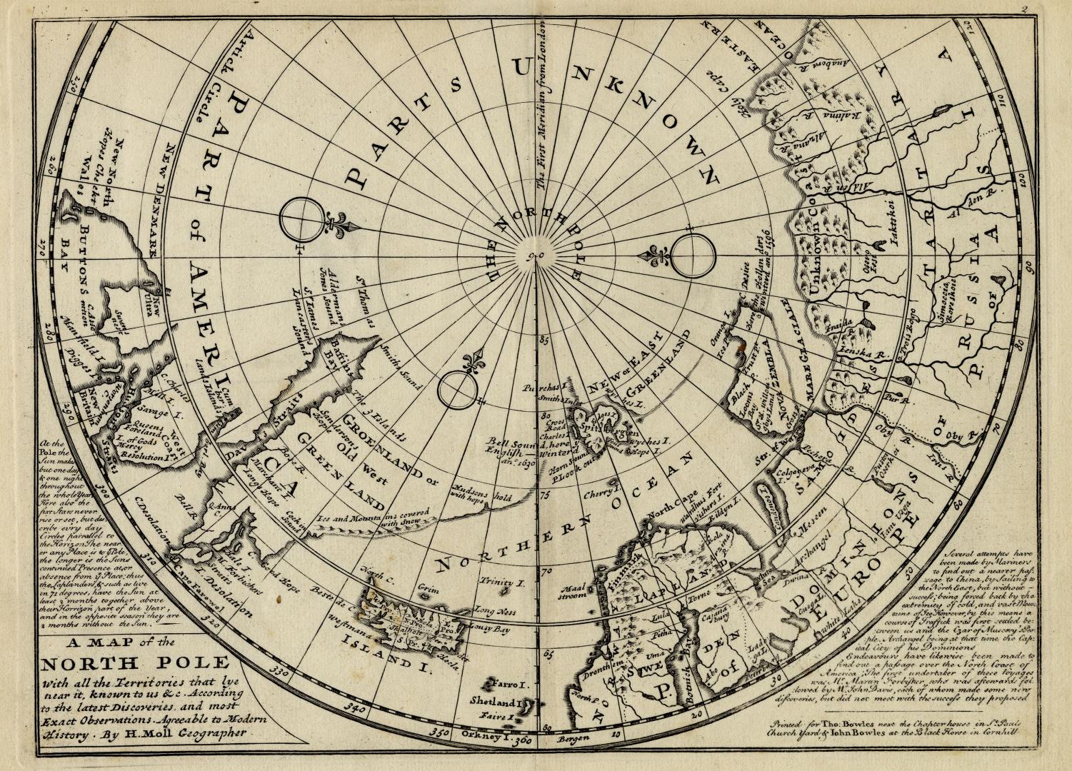

A map of the North Pole with all the territories that lye near it, known to us &c according to the latest discoveries, and most exact observations agreeable to modern history
DateApproximately 1732
Names
Moll, Herman, -1732
(cartographer)
Tho. Bowles and John Bowles
(publisher)
Moll, Herman, -1732
(engraver)
FormatMap
Subject
Medium
Dimensions24 x 33 cm.
Language
CollectionBaldwin Collection of Canadiana
Usage Rights
Public Domain
(Learn More)
Object Number912-98-M58-SMALL
Dewey912.98 M58 small (Arctic Maps drawer)