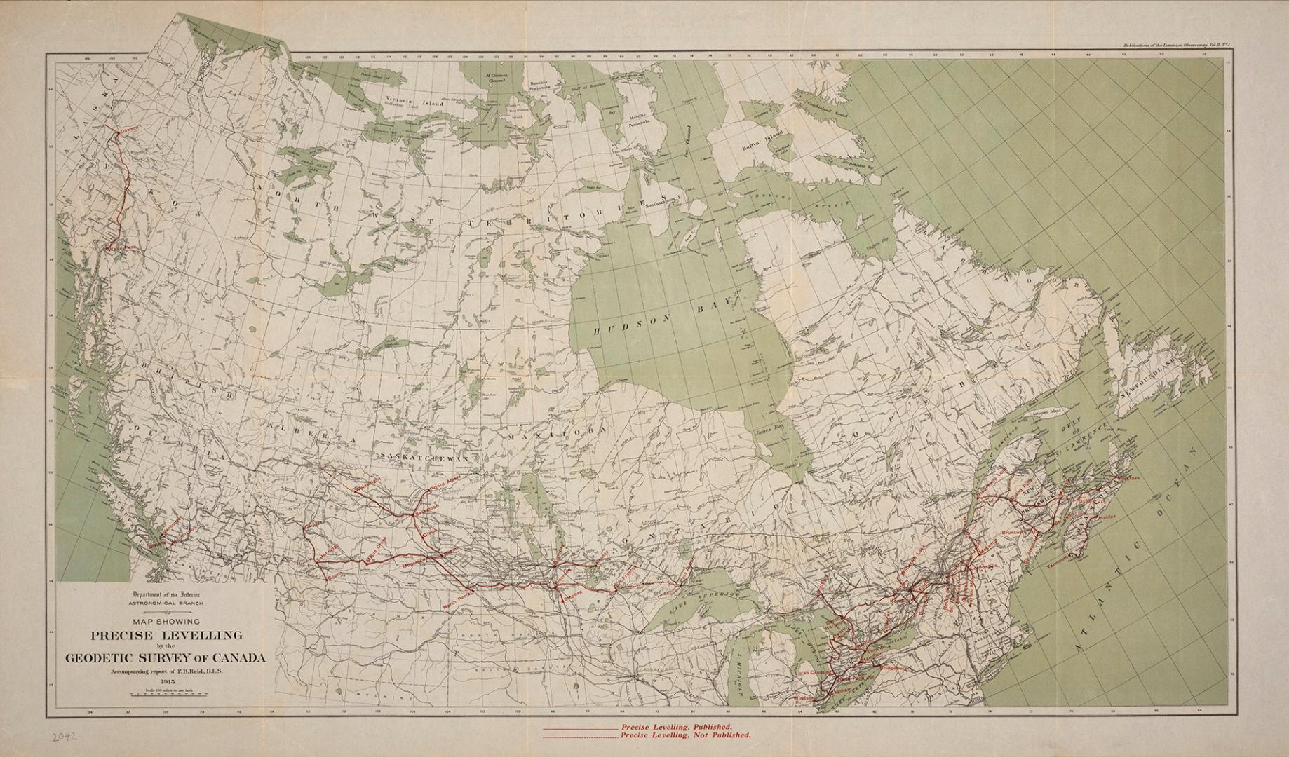

Map showing precise levelling by the Geodetic Survey of Canada
Date1915
Names
Canada. Department of the Interior
(author)
Government Printing Bureau
(printer)
Format
| Department of the Interior, Astronomical Branch. The map accompanies a report by F.B. Reid, D.L.S. which the library has in microfiche format: https://www.torontopubliclibrary.ca/detail.jsp?Entt=RDM2608394&R=2608394 |
Subject
Dimensions56.5 cm x 98 cm (22 1/4 in. x 38 9/16 in.)
Scale1 inch = 100 miles
Language
CollectionBaldwin Collection of Canadiana
Usage Rights
Public Domain
(Learn More)
Call Number / Accession Number912-71-C12-1
Dewey Number912.71 C12.1
Country:Canada
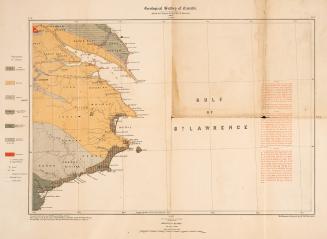
Approximately 1870