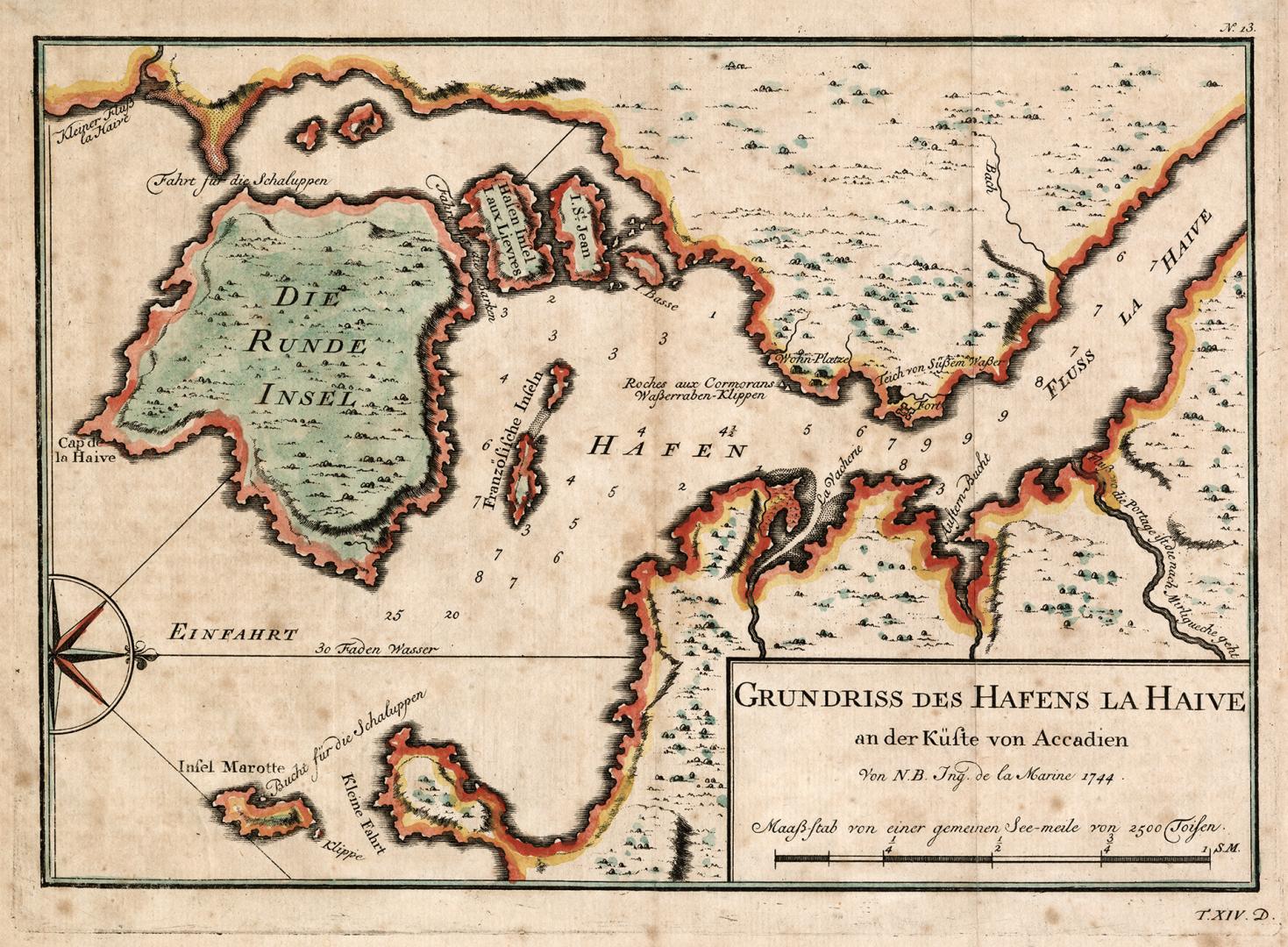

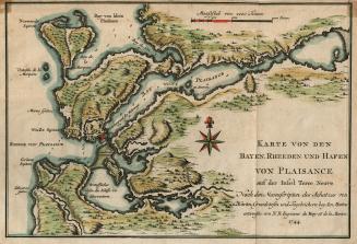
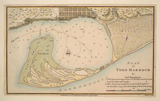
Grundriss des Hafens la Haive an der Kufte von Accadien
Date1756
Names
Bellin, Jacques Nicolas, 1703-1772
(cartographer)
Format
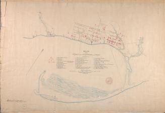
Map of the Bay of
LaHave. Bellin’s interpretation of the islands however are a bit confused as
I’sle Ronde incorporated Cape LaHave Island as well as several smaller ones .
I. St. Jean represents Hirtles Island while several other islands in Dublin Bay
appear to be mislocated. From “Allgemeine Historie der Reisen zu Wasser und zu
Lande” Leipzig.
Medium
Dimensions24 cm x 33 cm (9 7/16 in. x 13 in.)
ScaleBar scale
Language
CollectionBaldwin Collection of Canadiana
Usage Rights
Public Domain
(Learn More)
Call Number / Accession Number912-71623-B25-SMALL
Dewey Number912.71623 B25 SMALL
Country:Canada
Province or state:Nova Scotia
Approximately 1908