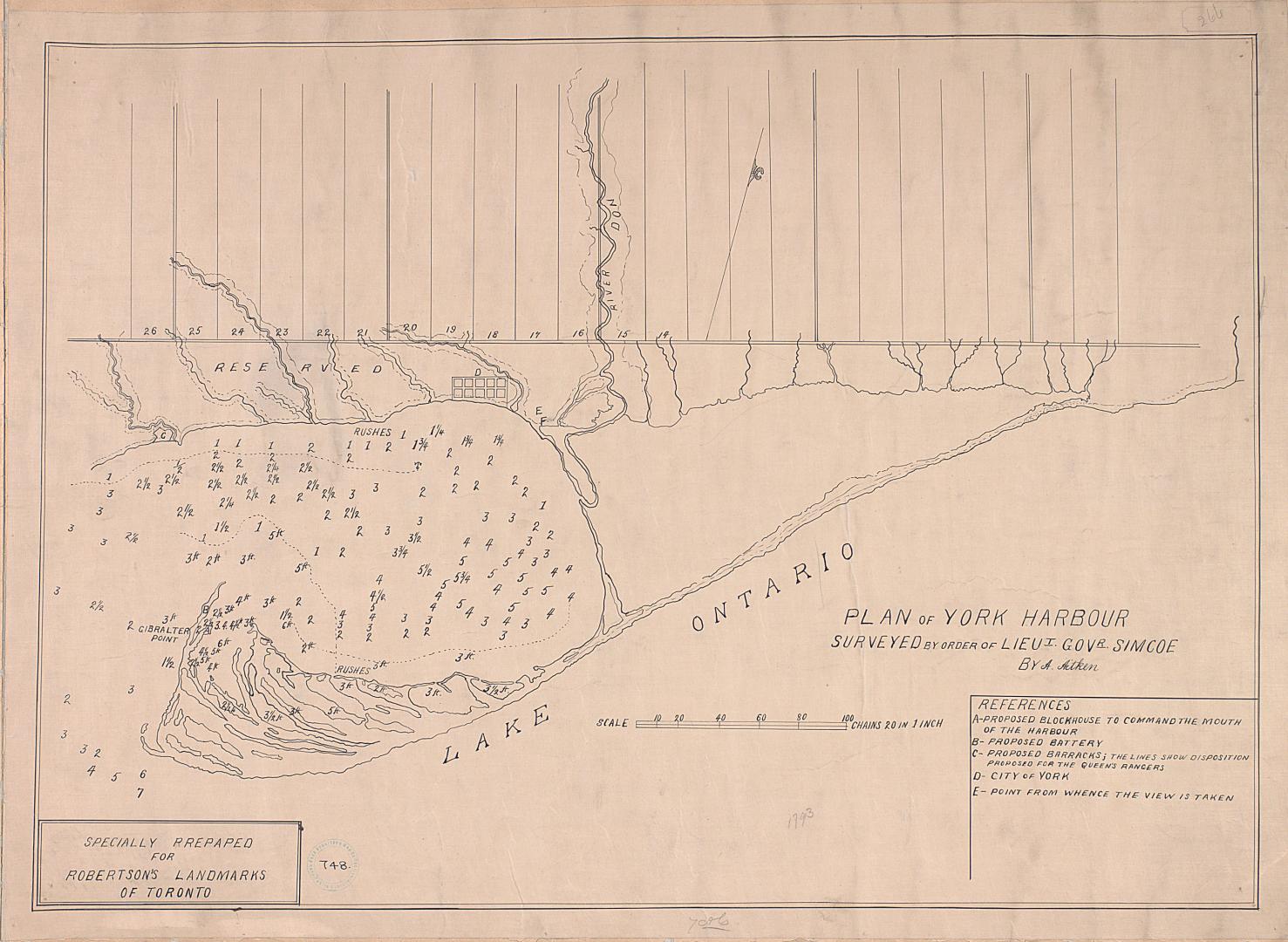

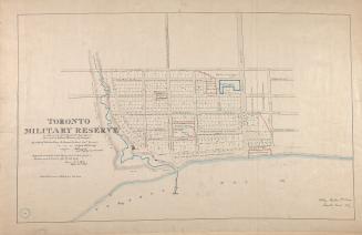
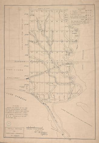
(1793) Plan of York harbour surveyed by order of Lieut. Govr. Simcoe by A. Aitken
Date1908
Names
Aitken, Alexander, -1800
(cartographer)
Robertson, J. Ross (John Ross), 1841-1918
(contributor)
Simcoe, John Graves, 1752-1806
(contributor)
FormatMap
NotesSpecially prepared for Robertson's Landmarks of Toronto. Approximately 1908 manuscript reproduction made of original 1793 map.
Dimensions55.5 cm x 75.5 cm (21 7/8 in. x 29 3/4 in.)
Scale1 inch = 20 chains
Language
ProvenanceGift of John Ross Robertson (JRR collection #748)
CollectionBaldwin Collection of Canadiana
Usage Rights
Public Domain
(Learn More)
Object NumberT-1793-LARGE
27 June 1908
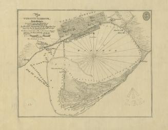
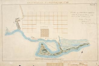
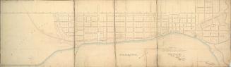
![(1788) Plan of Torento [sic] Harbour with the proposed town and part of the settlement, Québec 6th Dec. 1788, Gothermann, Capn. Commandg. Rl. Engrs. Colonial Correspondence Canada (Québec) 1790 no. 47 Plan B](/internal/media/dispatcher/2237612/thumbnail)
1837