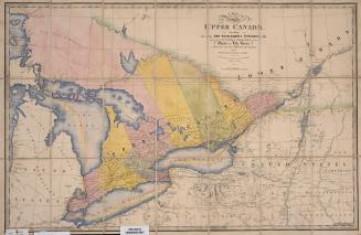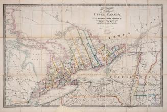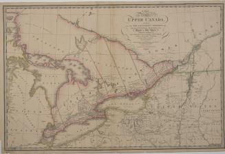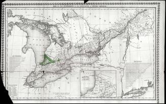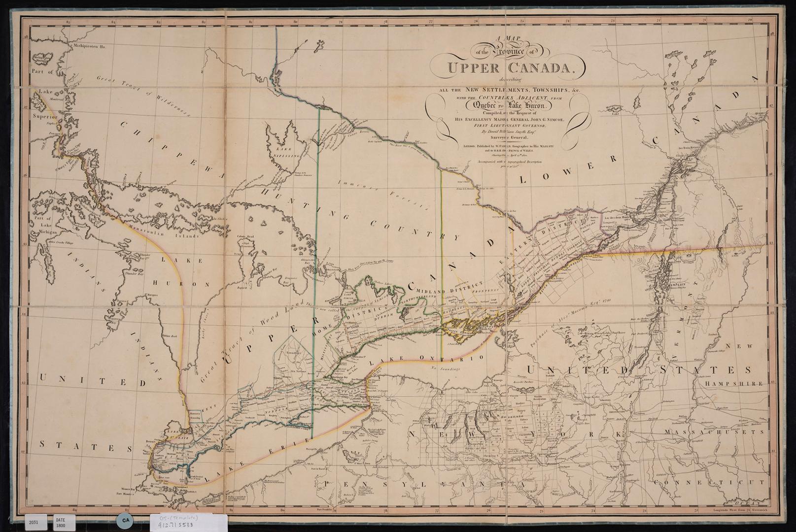

A map of the province of Upper Canada describing all the new settlements and townships &c. with the countries adjacent from Québec to Lake Huron
Date12 April 1800
Names
Smyth, David William, Sir, 1764-1837
(author)
Faden, William, 1750-1836
(publisher)
Format
The first printed map of Upper Canada.
Subject
Medium
Dimensions59 cm x 88 cm (23 1/4 in. x 34 5/8 in.)
Language
CollectionBaldwin Collection of Canadiana
Usage Rights
Public Domain
(Learn More)
Call Number / Accession Number912-71-S538
Dewey Number912.71 S538
Country:Canada
Historical location:Upper Canada
Province or state:Québec