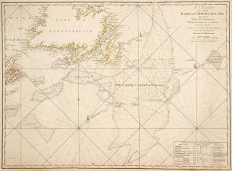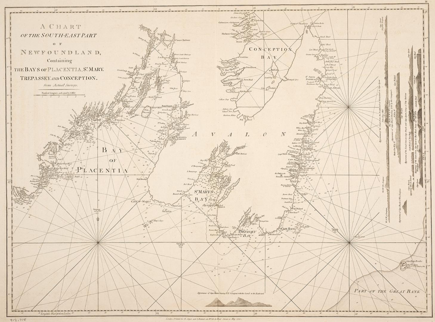

A chart of the south-east part of Newfoundland
Date1770
Names
Sayer, Robert, 1725-1794
(publisher)
Bennett, John
(publisher)
FormatMap
NotesContains the bays of: Placentia, St. Mary, Trepassey and Conception.
Dimensions56 cm x 74.5 cm (22 1/16 in. x 29 5/16 in.)
ScaleBar scale (nautical leagues, each equal to 3 miles)
Language
CollectionBaldwin Collection of Canadiana
Usage Rights
Public Domain
(Learn More)
Object Number912-718-S138-11-MEDIUM
Dewey912.718 S 138.11 (medium)