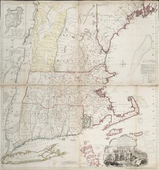
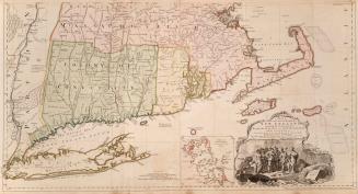
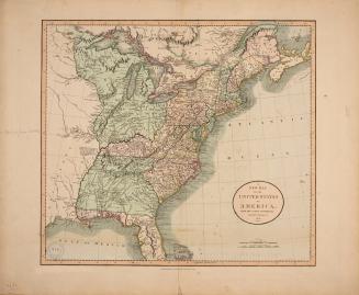
A new map of part of the United States of North America containing those of New York, Vermont, New Hampshire, Massachusetts, Connecticut, Rhode Island, Pennsylvania, New Jersey, Delaware, Maryland and Virginia, from the latest authorities
Date1806
Names
J. Cary
(publisher)
Cary, John, approximately 1754-1835
(cartographer)
Cary, John, approximately 1754-1835
(engraver)
FormatMap
Subject
Dimensions55.5 cm x 66.3 cm (21 7/8 in. x 26 1/8 in.)
ScaleBar scale (German Miles 15)
ScaleBar scale (Common French Leagues 25)
ScaleBar scale (British Statute Miles 69 1/2 to a degree)
Language
CollectionBaldwin Collection of Canadiana
Usage Rights
Public Domain
(Learn More)
Object Number912-73-C13-2-MEDIUM